Loading this page…

Loading this page…
Marina service
About
Hopetoun Maritime Facility is a compact town-centre maritime facility with a service jetty, boat ramp, hardstand area, public toilets and parking for local and visiting trailer boats.
Service area: Hopetoun, Western Australia
Keep exploring
Use this listing for Hopetoun's practical public boating facility rather than a full private marina. WA Transport describes a town-centre facility made up of a service jetty, boat launching ramp, hardstand area, public toilets and parking. It is best suited to trailer boats, fishing vessels and local coastal boating around Mary Ann Haven, with skippers checking conditions and local ramp suitability before arrival.
Published detail on the facility is sparse, and the honest description is of a basic but functional government boat harbour. The service jetty provides fixed, side-to berthing suitable for vessels in the 10 to 20 metre range, with charted depths of two to three metres at low water and good manoeuvring room; the department lists excellent channel marking into the haven.
The concrete launching ramp at Mary Ann Point is a single-lane sealed ramp with a finger jetty and parking for around 50 cars and trailers, and a hardstand area behind the foreshore provides space for vessels to be set down for work or storage, with haul-out capability noted in directory listings. Public toilets, water and parking round out the amenities. Fees are payable under the state's maritime facilities schedule, and the department asks all users to contact its Esperance office before arrival to confirm facilities, arrange documentation and organise payment; users must also comply with the department's gas, electrical and insurance conditions.
There is no fuel berth, no chandlery, no showers or laundry, and no marine trades in town, so vessels need to arrive self-sufficient; the nearest full-service ports are Albany, about 258 kilometres by road to the west, and Esperance, 239 kilometres east. VHF channels 16, 72 and 73 are monitored locally. For trailer boats the ramp and the haven's sheltered water are the draw, while larger cruising boats use the jetty as a refuelling-free rest stop, topping up water, walking to the shops and waiting out weather in the lee of the breakwater.
Mary Ann Haven is one of the few sheltered inlets on this otherwise bold stretch of Southern Ocean coast, and the entrance channel near 33.954 south, 120.125 east is well marked, though the department warns of tidal flow in the entrance and depths that demand attention from deeper-keeled yachts. Two to three metres at low water is the working figure. The haven's real value is what it opens up.
West of town, Hamersley Drive runs into the Fitzgerald River National Park, a 330,000-hectare UNESCO-listed biosphere with boat launching at Hamersley Inlet, whale watching from Cave Point between June and October, and beaches backed by the East Mount Barren range; to the east, the coastal road passes Mason Bay and Starvation Boat Harbour, a sheltered alternative launch site with camping.
Fishing is the town's main recreation: salmon in season, herring, nannygai and queen snapper offshore, bream in the inlets, and an annual fishing competition over the Easter weekend fills the town. Ashore, Hopetoun has a hotel, motel, bakery, supermarket, cafe and caravan park within walking distance of the jetty, and Ravensthorpe, 49 kilometres north, supplies the hospital, visitor centre and heavier services; the nickel mine between the two towns has cycled the district's fortunes up and down for decades.
Cruising yachts along the south coast should note the long gaps in facilities either side; Hopetoun's jetty, for all its simplicity, is a genuinely useful refuge between Albany and Esperance when the Southern Ocean turns hostile. The maritime museum at Albany and the replica brig Amity make a worthwhile side trip for crews waiting on weather, and the Ravensthorpe wildflower season in spring draws its own visitors through town.
Satellite imagery at four heights, from the wider harbour to the berths.
Recently received AIS vessel positions around Hopetoun Maritime Facility. The traffic display loads automatically.
Live traffic will appear after Hopetoun Maritime Facility has verified map coordinates.
Dangar Island sits in the lower Hawkesbury River close to Brooklyn and is one of Sydney’s small, boat‑access communities. From the water it reads as a wooded, low island with sandy foreshore, a public jetty and private moorings; its position at the mouth of Cowan Creek and close to the main river channel makes it an attractive short‑cruise destination for trailer sailors, runabouts and small cruisers but also one that requires careful local knowledge and respect for resident berths, ferry operations and tidal currents.

Use ramps and beaches with respect for local conditions: check ramp layout, tide and swell, wind direction, vehicle access and crowding; prepare boat and crew before you launch or retrieve; and follow local signage, courtesy and safety practices. Specifics vary by ramp and beach, so confirm details for the exact site before you go.
Explore →
Maybe — it depends. In NSW you often need registration and a boat operator licence for motorised vessels, but many small trailerable sailing dinghies without engines don’t require boat registration or a licence. Check the specific rules for your craft, trailer and engine.
Explore →
Pick a ramp that matches your boat size and trailer setup, has safe approach and exit conditions (depth, slope, surface), good onshore parking and flow, and follow simple ramp etiquette: queue, help others, rig off the trailer when clear, and secure your vessel quickly.
Explore →
Yes — South Australian coastal waters include marine parks, aquatic reserves, harbour bylaws and local council restrictions that can affect anchoring, fishing, mooring and access; check the relevant state agencies, local councils and Notices to Mariners for location-specific rules and permit requirements.
Explore →Practical guide for recreational sailors in Pittwater covering safe anchorages, popular beaches, typical weather patterns, tidal and local considerations, boat handling and a pre-departure checklist tailored to local conditions.
Explore →Practical guide for recreational sailors planning passage on the Hawkesbury River: how to plan around tides, choose anchorages, read local conditions and prepare the boat and crew for a safe, comfortable trip.
Explore →A practical guide for recreational sailors planning passages to, from or around Eden and Twofold Bay. Covers sheltered anchorages, shore facilities, local weather and tidal considerations, preparing for Bass Strait conditions and a focused equipment and safety checklist.
Explore →A practical guide for recreational sailors planning visits to Albany and King George Sound. Covers the main anchorage areas, typical local weather patterns, tidal and current considerations, navigational hazards, on-the-water etiquette and a pre-departure checklist to help you plan a safe passage and enjoyable stopover
Explore →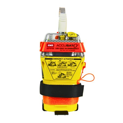
A 10‑year battery EPIRB with integrated GNSS (supports GPS and Galileo), infrared strobe and 121.5 MHz homing signal. Approved for worldwide COSPAS‑SARSAT operation.
Explore →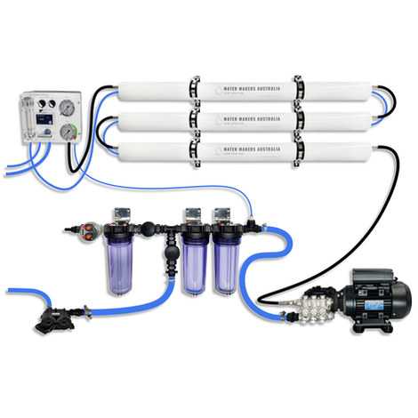
A three-membrane modular watermaker with 200 L/h nominal output and up to 240 L/h family-level marketing, for larger crews and heavy use.
Explore →
Self-contained, battery-powered plug‑and‑play autopilot designed for standard hydraulic steering systems.
Explore →Burke Yachtsman Gear Bag 40L - Shop Now Zip Pay | Tamar Marine Skip to content 59 – 63 Holbrook Street, Invermay Online Shop Open 24/7 Products search Contact us 1300 MARINE $ 0.00 0 Cart Burke Yachtsman Gear Bag 40L $ 79.90 Colour Choose an option Black Blue Black Blue Clear - Burke Yachtsman Gear Bag 40L quantity + Add to cart Enquire about this product SKU BAGB-Y24/BLACK* Category Bags - Sail & Gear A Burke classic and customer favourite, the Yachtsman’s Gear Bag is built tough to handle wet, salty conditions while keeping your gear dry and protected. Made from double coated waterproof…
Explore →