Loading this page…

Loading this page…
About
Marina Adelaide is the Largs North / Port Adelaide River marine-services precinct, with around 175 berths, boat ramp, fuel dock, storage, service facilities and large travel lifts.
Service area: Largs North / Port River, Adelaide, SA
Keep exploring
Current redevelopment and industry sources describe up to 175 berths for vessels up to about 30 m, marina facilities, boat ramp, fuel dock, storage/service facilities, maintenance sheds and 75- and 150-tonne travel lifts.
The marina holds 175 fully serviced berths for vessels up to around thirty metres, with deep-water access; published minimum depths vary between 3.5 and 4.5 metres LAT depending on source and dredging stage, so keelboats drawing over two metres should confirm the current figure. Shore power runs from standard 15-amp outlets up to three-phase 100-amp supply for larger motor yachts, and water is laid on at berth. A fuel berth just inside the basin entrance sells diesel and petrol around the clock, and pump-out facilities are provided. The whole site is monitored 24/7 by CCTV with motion detection and person-of-interest tracking, and there is a public boat ramp on the Snowdens Beach side.
Haul-out is the core trade. A 75-tonne travel lift handles vessels to a 6.7-metre beam, and a 150-tonne lift has been added, with management publicly flagging a longer-term ambition for an 800 or 1,000-tonne machine that would open the yard to serious commercial tonnage. The purpose-built hardstand offers DIY space for owners who want to do their own antifouling and fit-out, alongside maintenance sheds and a tenant mix covering most marine trades: engineering, electrical, shipwright work, painting and project management for refits.
The office coordinates refit and repair work across tenants, so an owner can book a lift, hardstand and trades in one conversation. Casual and permanent berthing are both offered; enquiries go through info@marinaadelaide.com.au or (08) 8169 0000. The yard's position inside the Port River, minutes from Gulf St Vincent, keeps delivery trips short. Diesel and petrol are both dispensed, and the fuel berth's position just inside the entrance means a vessel can top up on the way in or out without penetrating the basin.
The approach is up the Port River from the Outer Harbor entrance, a well-marked commercial channel that shares water with container ships and the cruise ship terminal, so keeping a listening watch and staying clear of shipping is routine. The basin entrance sits off Snowdens Beach on the Largs North shore; the sailing club occupies the eastern side and the marina the western, and first-time visitors should identify the right entrance before committing. Depths in the river are dependable, and the Port Adelaide dolphin sanctuary, with its resident pod, lies further upriver toward Garden Island.
By road the site is reached via Willochra Street off the Port River Expressway corridor, with George Robertson Drive leading into the yard. Port Adelaide's revived waterfront - pubs, the maritime museum, weekend markets - is ten minutes south, and Semaphore's beachfront cafes are a short drive north. For cruising, Gulf St Vincent opens immediately west: the metropolitan beaches, the Port River estuary and the run across to Kangaroo Island all start here.
The concentration of marinas along this coast - the Royal South Australian Yacht Squadron at Outer Harbor, the CYCSA and the North Haven basin marinas to the north - means a full day's maintenance stop can be combined with a berth change without ever leaving sight of land. Provisioning is straightforward, with supermarkets at Port Adelaide and West Lakes within fifteen minutes.
For visiting crews the yard is also a practical winter address: hardstand rates and the tenant trades make it the natural place to lay up for a refit season, with the CBD close enough for parts runs and the airport twenty minutes away for crew changes.
Satellite imagery at four heights, from the wider harbour to the berths.

Use ramps and beaches with respect for local conditions: check ramp layout, tide and swell, wind direction, vehicle access and crowding; prepare boat and crew before you launch or retrieve; and follow local signage, courtesy and safety practices. Specifics vary by ramp and beach, so confirm details for the exact site before you go.
Explore →
Local rules, marine‑park zoning and permit needs vary by reserve around South Australia’s coast — check the relevant marine park zoning map and SA Department for Environment and Water (DEW) information for the exact area before you go.
Explore →
Plan passages across Spencer Gulf or to Kangaroo Island by basing fuel on your boat’s actual consumption plus a generous reserve, choosing sensible staging/stop options that match your boat and crew, and prioritising shelter and weather windows (gale fronts, strong winds and tidal streams can make the gulf uncomfortable or unsafe). Confirm fuel availability, safe anchorages or marinas on your route, and check up-to-date local weather, tide and navigation information before you go.
Explore →
Expect light to moderate, thermally-driven sea breezes in summer with afternoon strengthening; more changeable and often stronger winds with frontal systems in autumn and spring; and the windiest, roughest conditions in winter when cold fronts and sou’westers are most frequent. Gulf St Vincent is more sheltered than the exposed coast but can still produce steep chop and sudden changes near Adelaide and headlands.
Explore →Practical guide for recreational sailors planning passage on the Hawkesbury River: how to plan around tides, choose anchorages, read local conditions and prepare the boat and crew for a safe, comfortable trip.
Explore →Practical guide for recreational sailors navigating the Swan River and coastal waters around Perth. Covers local weather patterns, tides and currents, river navigation, launching and berthing options, safety equipment, common hazards, and step-by-step pre-departure and on-water checklists tailored to Western Australian
Explore →A practical guide for recreational sailors planning day sails or short cruises around Batemans Bay, Broulee and the Clyde River. Covers local conditions, safe approaches, anchorages, launching, tides, common hazards, and checklists for trip planning and on-water decisions.
Explore →Practical guide for recreational sailors planning passages, anchorages and visits to Ningaloo Reef and the Exmouth coast. Covers anchoring considerations, marine park rules and how local weather, tides and currents affect safety and enjoyment.
Explore →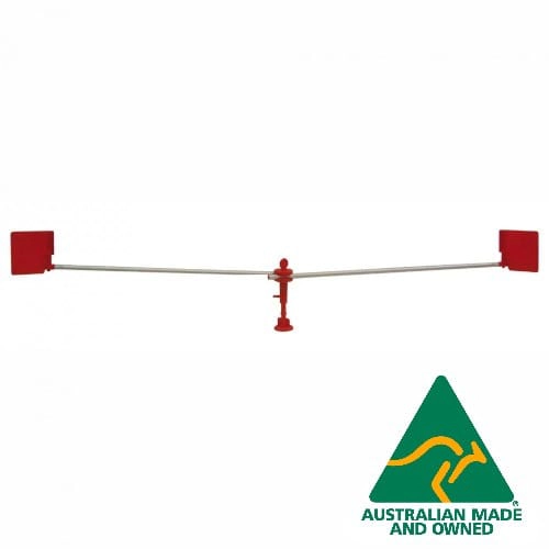
Wind-driven bird repeller with 2 metre rotating arms that keeps birds from roosting on hardtops, biminis, booms and decks. UV stabilised, with a bayonet base and a 12 month warranty.
Explore →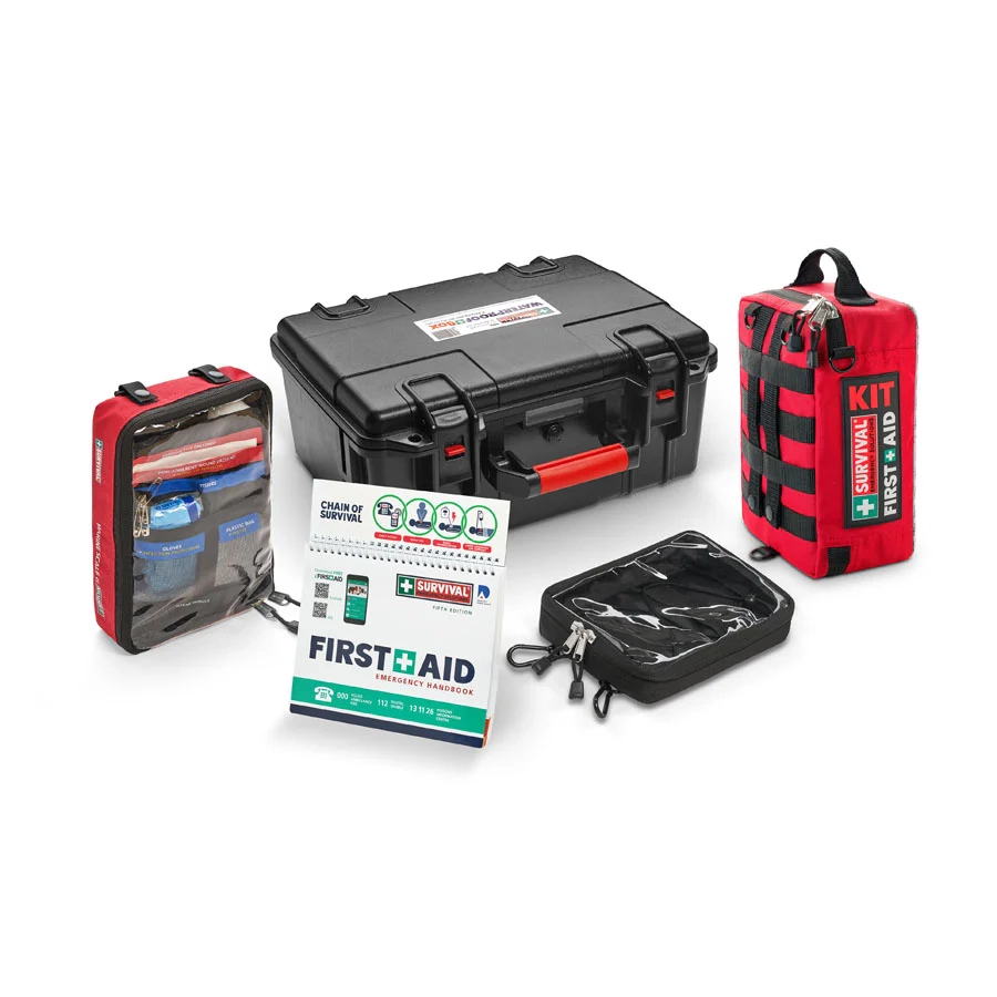
A 142-item marine first aid kit built around the Australian Scale G requirement, with a workplace kit, a Scale G module and a handbook packed in a large waterproof box.
Explore →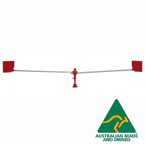
Wind-driven bird repeller with 1 metre rotating arms for smaller areas such as a boom, a solar panel or a small bimini. UV stabilised, with a bayonet base and a 12 month warranty.
Explore →
Metal-bodied 4G push-to-talk radio with GPS and SOS in the GPS variant and a lifetime SIM plan included. Sold as a two-pack.
Explore →