Loading this page…

Loading this page…
Marina service
About
Slip Road Maritime Precinct Marina is a distinctive Paynesville boating base, bringing working marine trades, vessel care and direct Gippsland Lakes access together in one rewarding waterfront destination.
Service area: Paynesville, Gippsland Lakes, VIC
Keep exploring
Slip Road Maritime Precinct Marina gives owners and visiting crews a well-positioned place to arrive, prepare and enjoy the water. Its identity is shaped by working marine trades, vessel care and direct Gippsland Lakes access, creating an experience grounded in the character of Paynesville.
Whether used as a home base or a passage stop, it connects boaters with both practical waterfront access and the best of the surrounding region.
The facility supports everyday boating through berthing or harbour access, nearby marine capability and convenient shore-side services. Its location helps crews organise vessel needs and return to the water efficiently.
The surrounding cruising ground is a major attraction: working marine trades, vessel care and direct Gippsland Lakes access. Slip Road Maritime Precinct Marina provides a natural starting point for exploring Paynesville and the wider Victorian coast or inland waterway.
Recently received AIS vessel positions around Slip Road Maritime Precinct Marina. The traffic display loads automatically.
Live traffic will appear after Slip Road Maritime Precinct Marina has verified map coordinates.
Bathurst Harbour (Port Davey system), in south‑west Tasmania, is a vast, almost land‑locked estuarine harbour inside the Southwest National Park and World Heritage Area. It offers a remote, sheltered anchoring environment protected from the Roaring Forties, but demands careful planning, an awareness of marine‑reserve rules, and a willingness to operate in shallow, tannin‑stained waters. Best suited to experienced coastal cruisers and small expedition yachts prepared for self‑sufficiency, Bathurst Harbour is more a place to linger and explore on foot and by tender than a port of call for busy,

Use ramps and beaches with respect for local conditions: check ramp layout, tide and swell, wind direction, vehicle access and crowding; prepare boat and crew before you launch or retrieve; and follow local signage, courtesy and safety practices. Specifics vary by ramp and beach, so confirm details for the exact site before you go.
Explore →
Plan as a chain of conservative daily legs tied to your boat’s real-world fuel and speed in the expected sea state, with confirmed primary and alternate anchorages/berths, fuel legs and back-up fuel options, and a documented emergency/diversion plan (comms, tow and med-evac). Build tidal and weather gates into each leg and carry chart and comms redundancy.
Explore →
Pick a ramp that matches your boat size and trailer setup, has safe approach and exit conditions (depth, slope, surface), good onshore parking and flow, and follow simple ramp etiquette: queue, help others, rig off the trailer when clear, and secure your vessel quickly.
Explore →
Expect light to moderate, thermally-driven sea breezes in summer with afternoon strengthening; more changeable and often stronger winds with frontal systems in autumn and spring; and the windiest, roughest conditions in winter when cold fronts and sou’westers are most frequent. Gulf St Vincent is more sheltered than the exposed coast but can still produce steep chop and sudden changes near Adelaide and headlands.
Explore →A practical guide for recreational sailors on using VHF marine radios safely and effectively in Australian waters: basic operation, channel use, emergency procedures, DSC basics, common mistakes and a ready checklist for pre-departure and on-water use.
Explore →A practical guide for recreational sailors planning trips in Jervis Bay. Covers typical weather patterns, sheltered anchorages, common hazards, marine park considerations, anchoring techniques and sensible trip planning for day sails and short cruises.
Explore →Practical guide for recreational sailors planning passages, anchorages and visits to Ningaloo Reef and the Exmouth coast. Covers anchoring considerations, marine park rules and how local weather, tides and currents affect safety and enjoyment.
Explore →
A practical step‑by‑step guide to planning a safe, realistic coastal sailing passage in Australian waters: choosing a route, estimating distance and time, checking weather and tides, fuel and daylight planning, identifying safe harbours and anchorages, and preparing backup plans.
Explore →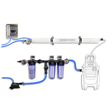
A one-membrane modular marine watermaker with 80 L/h nominal output, remote stainless control panel, standard consumables and direct Australian support.
Explore →Burke Yachtsman Gear Bag 40L - Shop Now Zip Pay | Tamar Marine Skip to content 59 – 63 Holbrook Street, Invermay Online Shop Open 24/7 Products search Contact us 1300 MARINE $ 0.00 0 Cart Burke Yachtsman Gear Bag 40L $ 79.90 Colour Choose an option Black Blue Black Blue Clear - Burke Yachtsman Gear Bag 40L quantity + Add to cart Enquire about this product SKU BAGB-Y24/BLACK* Category Bags - Sail & Gear A Burke classic and customer favourite, the Yachtsman’s Gear Bag is built tough to handle wet, salty conditions while keeping your gear dry and protected. Made from double coated waterproof…
Explore →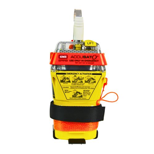
A 10‑year battery EPIRB with integrated GNSS (supports GPS and Galileo), infrared strobe and 121.5 MHz homing signal. Approved for worldwide COSPAS‑SARSAT operation.
Explore →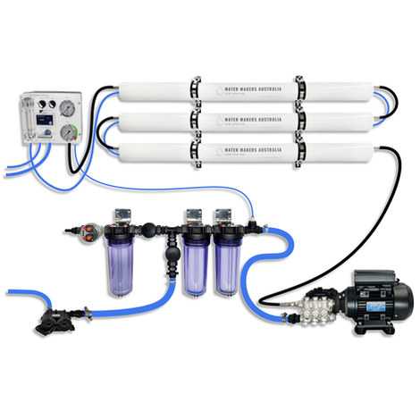
A three-membrane modular watermaker with 200 L/h nominal output and up to 240 L/h family-level marketing, for larger crews and heavy use.
Explore →