Loading this page…

Loading this page…
Marina service
About
Dingo Beach Boat Ramp is a public Whitsundays launch facility at Dingo Beach / Cape Gloucester, with beachside amenities and access to northern Whitsunday waters.
Service area: Dingo Beach (Cape Gloucester), Whitsundays, QLD
Keep exploring
Use this listing as a public boat-ramp record, not a marina. Queensland and local sources describe a public boat ramp on the Dingo Beach foreshore, with nearby toilets, showers, BBQs, picnic tables, shaded playground and swimming enclosure.
The facility comprises a two-lane concrete ramp on the Dingo Beach beachfront, upgraded from its original single lane with a short extension to deepen the usable tidal window, and informal trailer parking along the foreshore reserve. Whitsunday Regional Council manages the completed facility under the standard state arrangement in which Transport and Main Roads builds the in-water works and councils supply and run the land-side components.
There are no berths, pontoons or moorings attached to the ramp, and no fuel, water, power, pump-out, lighting or fish-cleaning facilities on site; boaters should arrive fully provisioned and fuelled. The nearest serious marine services, including fuel, mechanical repairs, chandlery and marina berthing, are at Coral Sea Marina and Port of Airlie in the Airlie Beach area, or at Bowen to the north. Cape Gloucester Resort, a few minutes away, operates its own small ramp for staying guests, which is the only other launching option on the cape.
There is no published fee for using the public ramp. Because the upgrade was specifically aimed at tidal access, the ramp now works through more of the tide cycle than the old structure, though very low tides still constrain launching and retrieval. Visitors should also note that mobile coverage in the settlement can be patchy, and there is no on-site kiosk, so ice, bait and food should be bought in Proserpine or Bowen before the drive out.
Queues form at the ramp on summer weekends and through the mackerel season, but on ordinary weekdays a solo launch is usually straightforward, and the beach alongside the ramp allows a temporary tie-up while the trailer is parked.
Launching at Dingo Beach puts a trailer boat straight into Edgecumbe Bay, a broad, open bay that can sharpen quickly when the south-east trade winds push against an outgoing tide, so small boats pick their days. The rewards are close at hand: Gloucester Island and its fringing reef lie a short run offshore, the Double Cone and Armit Island groups offer snorkelling and picnic anchorages, and the northern Whitsunday passages are reachable in settled weather by capable boats.
The bay fishes well for mackerel, trevally and reef species, and the creeks of the cape hold mud crabs. The settlement itself is low-key, a grid of beach houses behind a long sand foreshore, with Dingo Beach Pub and a scattering of holiday accommodation providing the only commercial life; the drive in along Dingo Beach Road crosses flat cane country and wetlands with reliable birdwatching. Crocodiles are part of the local reality, and the Be Crocwise advice applies to creeks and estuaries around the cape.
Stinger suits are the rule in the water from November to May. Tides in Edgecumbe Bay run to around three metres, and the shallow foreshore means anchoring off the beach is a rising-tide exercise. For many locals the ramp's real value is the morning routine: launch at first light, fish the bay, and be home before the sea breeze stands up. Proserpine, the nearest town of any size, has fuel, bait and tackle outlets and a supermarket, making it the logical provisioning stop on the way through.
Satellite imagery at four heights, from the wider harbour to the berths.
Recently received AIS vessel positions around Dingo Beach Boat Ramp. The traffic display loads automatically.
Live traffic will appear after Dingo Beach Boat Ramp has verified map coordinates.
Bathurst Harbour (Port Davey system), in south‑west Tasmania, is a vast, almost land‑locked estuarine harbour inside the Southwest National Park and World Heritage Area. It offers a remote, sheltered anchoring environment protected from the Roaring Forties, but demands careful planning, an awareness of marine‑reserve rules, and a willingness to operate in shallow, tannin‑stained waters. Best suited to experienced coastal cruisers and small expedition yachts prepared for self‑sufficiency, Bathurst Harbour is more a place to linger and explore on foot and by tender than a port of call for busy,

Use ramps and beaches with respect for local conditions: check ramp layout, tide and swell, wind direction, vehicle access and crowding; prepare boat and crew before you launch or retrieve; and follow local signage, courtesy and safety practices. Specifics vary by ramp and beach, so confirm details for the exact site before you go.
Explore →
Pick a ramp that matches your boat size and trailer setup, has safe approach and exit conditions (depth, slope, surface), good onshore parking and flow, and follow simple ramp etiquette: queue, help others, rig off the trailer when clear, and secure your vessel quickly.
Explore →
Pick a protected bay, estuary or river reach where you can rig, launch and arrive on calm water within a short, sheltered transit; choose a site with a good ramp or jetty, clear recovery options and a nearby sailing club, marina or commercial operator for local knowledge and help.
Explore →
Rig and de-rig a small dinghy by following a consistent, step-by-step sequence: prepare the boat on shore, fit spars and foils in a stable order, control sails and running rigging so lines don’t tangle, check fittings and safety gear, and reverse the process when coming ashore—always working with a partner when possible and staying aware of wind and tide.
Explore →A concise, practical introduction to the essential parts of a recreational sailing boat for beginners in Australia. Covers hull, deck, rigging, sails, steering, below-decks spaces and safety equipment, with simple explanations, common mistakes and a pre-decast checklist to help new sailors communicate and get underway.
Explore →Practical guidance for recreational sailors planning to cross coastal bars in New South Wales. Explains how to assess conditions, plan a crossing, prepare equipment and crew, recognise hazards and manage emergencies, with checklists and realistic examples relevant to NSW waters.
Explore →
A practical checklist and explanation of the safety equipment recreational sailors should carry in Australian waters, with how to choose gear, use it correctly, and common mistakes to avoid.
Explore →A practical guide for recreational sailors on using VHF marine radios safely and effectively in Australian waters: basic operation, channel use, emergency procedures, DSC basics, common mistakes and a ready checklist for pre-departure and on-water use.
Explore →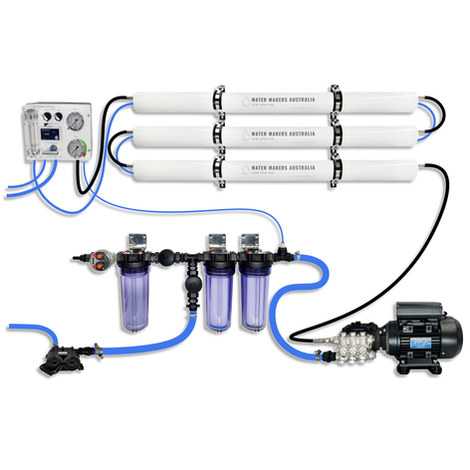
A three-membrane modular watermaker with 200 L/h nominal output and up to 240 L/h family-level marketing, for larger crews and heavy use.
Explore →Burke Yachtsman Gear Bag 40L - Shop Now Zip Pay | Tamar Marine Skip to content 59 – 63 Holbrook Street, Invermay Online Shop Open 24/7 Products search Contact us 1300 MARINE $ 0.00 0 Cart Burke Yachtsman Gear Bag 40L $ 79.90 Colour Choose an option Black Blue Black Blue Clear - Burke Yachtsman Gear Bag 40L quantity + Add to cart Enquire about this product SKU BAGB-Y24/BLACK* Category Bags - Sail & Gear A Burke classic and customer favourite, the Yachtsman’s Gear Bag is built tough to handle wet, salty conditions while keeping your gear dry and protected. Made from double coated waterproof…
Explore →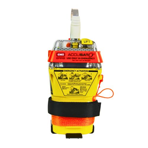
A 10‑year battery EPIRB with integrated GNSS (supports GPS and Galileo), infrared strobe and 121.5 MHz homing signal. Approved for worldwide COSPAS‑SARSAT operation.
Explore →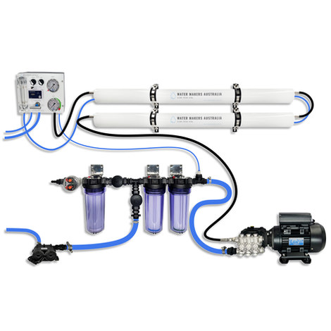
A two-membrane modular watermaker with 140 L/h nominal output, aimed at families and liveaboards that want more water per run.
Explore →