Loading this page…

Loading this page…
About
Dungeness Boat Harbour at Lucinda provides boat ramps, jetties and harbour access for local fishing, Hinchinbrook Channel boating and visiting recreational vessels.
Service area: Lucinda, Hinchinbrook, QLD
Keep exploring
Use this listing for Lucinda/Dungeness harbour access rather than a large marina. Hinchinbrook Shire identifies Dungeness Fishing Jetty, Commercial Jetty, Dungeness Jetty and Dungeness Boat Ramp among its marine facilities, supporting fishing, commercial and recreational boating.
The core facility is a four-lane concrete ramp described by the local sportfishing club as sheltered and suitable for boats to about ten metres, flanked by floating walkways and pontoons that ease boarding at busy times; an additional floating walkway was funded through a Maritime Safety Queensland boating infrastructure grant, which tells you how much traffic the site carries. A dedicated two-lane boat washdown bay sits in the ramp precinct, along with a bitumen car and trailer park, and public toilets open around the clock.
There is no berthing, no marina fuel berth and no shipyard service on the water; what the precinct does have is commerce built around the ramp, with a fuel station, convenience store and fishing shop close at hand, plus bait and ice from the Lucinda Fishing Lodge, which also rents waterside units with private pontoons where guests can leave their boats afloat between trips. Launching is free and unstaffed, operating on the usual Queensland public facility basis.
Larger repairs and mechanical work head back to Ingham, the district service town about half an hour away, or north to Cardwell and south toward Townsville. The ANSA Queensland fishing festival run by the Hinchinbrook Sportfishing Club each spring shows the ramp's calendar role: briefing nights at Borello Park, dawn departures from Dungeness, and weigh-ins back at the Ingham showgrounds.
For visiting cruisers, the harbour is a shore base rather than a destination; yachts heading for Hinchinbrook Island's east-coast anchorages typically berth or anchor elsewhere and use Dungeness for crew changeovers, trail transfers and provisioning runs into Lucinda.
Two pieces of local knowledge matter more than any chart note at Dungeness. First, the ramp itself: around low tide the end of the concrete can be nearly exposed on bigger tides, so launching and retrieving from half tide to full is the comfortable window. Second, the channel out to the Hinchinbrook Channel: even following the markers, boats can touch on the sand bar on big tides, and for roughly two hours either side of a large low tide deeper-draft boats may not get in or out at all; locals simply plan their day around it.
Once in the channel, the options run both ways: north toward Missionary Bay and the nine creeks, or south past the mouth of the Herbert River, with an extensive flats system directly opposite the ramp that drains fast and strands the inattentive for hours. The fishing is the draw: barramundi in the creeks and drains, fingermark and threadfin, and reef species out toward the Palm group when the weather allows.
Hinchinbrook Island dominates everything, Australia's largest island national park, and Dungeness is the standard departure for Thorsborne Trail transfers, a ten-minute run across the channel to Ramsay Beach. Crocs are resident in the channel, so swim only where the locals do. Lucinda supplies the social end of the trip: the Lucinda Point Hotel for the classic post-fishing dinner, the fishing wharf at Borello Park for land-based casting, and caravan parks and motels strung along the point.
The giant sugar jetty loading bulk raw sugar from the Herbert River mills is the district's industrial landmark, and a reminder that this quiet ramp shares its channel with a working export port.
Satellite imagery at four heights, from the wider harbour to the berths.
Recently received AIS vessel positions around Dungeness Boat Harbour. The traffic display loads automatically.
Live traffic will appear after Dungeness Boat Harbour has verified map coordinates.

Plan to use tide and local knowledge, slow and steerable power, and deliberate positioning to work with—rather than fight—strong streams and eddies when entering or leaving Tasmanian harbours.
Explore →
Expect the usual IALA-B lateral system (red and green), cardinal and isolated-danger marks, safe-water and special marks, plus harbour-specific fairway buoys, leading/transit marks and exclusion or speed‑limit buoys. Check local harbour charts and Notices to Mariners for exact positions and light characteristics before entry.
Explore →
Use ramps and beaches with respect for local conditions: check ramp layout, tide and swell, wind direction, vehicle access and crowding; prepare boat and crew before you launch or retrieve; and follow local signage, courtesy and safety practices. Specifics vary by ramp and beach, so confirm details for the exact site before you go.
Explore →
Yes — South Australian coastal waters include marine parks, aquatic reserves, harbour bylaws and local council restrictions that can affect anchoring, fishing, mooring and access; check the relevant state agencies, local councils and Notices to Mariners for location-specific rules and permit requirements.
Explore →Practical guide for recreational sailors visiting Albany and King George Sound. Covers typical weather patterns, sheltered anchorages, local hazards, tides and currents, berthing and shore access, pre-departure checks and sensible safety practices tailored to south-west Western Australia.
Explore →Practical guide for recreational sailors approaching Fremantle Harbour: what to expect on the approaches, local weather and tidal influences, navigational considerations, berthing and facilities, communications and safety checks, common mistakes and sensible next steps.
Explore →
A practical guide for recreational sailors planning a passage through Hinchinbrook Channel, covering route considerations, tides and currents, anchorages, hazards, local weather patterns, provisioning and safety checklists tailored to Australian conditions.
Explore →A practical, step‑by‑step guide for recreational sailors on Sydney Harbour covering navigation, local weather and tides, safe anchoring, berthing, common routes, rules of the road, and useful checklists tailored to Australian conditions.
Explore →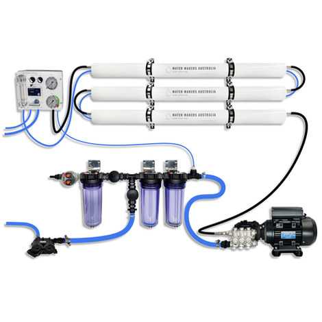
A three-membrane modular watermaker with 200 L/h nominal output and up to 240 L/h family-level marketing, for larger crews and heavy use.
Explore →
Self-contained, battery-powered plug‑and‑play autopilot designed for standard hydraulic steering systems.
Explore →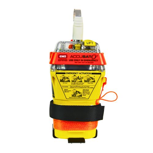
A 10‑year battery EPIRB with integrated GNSS (supports GPS and Galileo), infrared strobe and 121.5 MHz homing signal. Approved for worldwide COSPAS‑SARSAT operation.
Explore →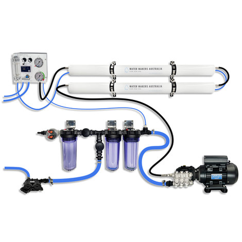
A two-membrane modular watermaker with 140 L/h nominal output, aimed at families and liveaboards that want more water per run.
Explore →