Loading this page…

Loading this page…
Marina service
About
Groper Creek Boat Harbour is a Burdekin Shire public creek-side boating area with boat-ramp access adjoining the Groper Creek community and fishing-club facilities.
Service area: Groper Creek (Home Hill), QLD
Keep exploring
Burdekin Shire identifies the Groper Creek Road boat ramp and notes facilities built by the local fishing club, supporting access to one of the Burdekin’s popular fishing areas.
The public infrastructure at Groper Creek is deliberately basic: two council boat ramps give access to the creek, and a central jetty serves as a fishing platform and temporary tie-up point for tenders. There are no berths, no fuel, no power or water points for boats, and no pump-out or lifting equipment; everything beyond launching happens at the caravan park or back in town. The Groper Creek Caravan Park, reachable on 0400 254 088, fills most of the practical gaps for visiting boaters.
It offers creek-front powered and unpowered sites, air-conditioned cabins, a kiosk selling basics and bait-adjacent supplies, gas refills, EFTPOS, laundry with washing machines, a dump point, barbecues and a playground, and it is pet friendly; the park's operators describe year-round fishing as the main draw and note that regulars book up to twelve months ahead. Trailer parking is informal around the ramps and the park.
For fuel, mechanical work, ice in quantity or serious provisioning, boaters drive the 15 to 17 kilometres back to Home Hill, or continue to Ayr, the Burdekin's main service town, which has supermarkets, marine dealers and tackle shops. There are no mooring fees published for the jetty or ramps. In short, the service model is self-sufficiency: launch at the ramp, keep your boat on the trailer or anchored off, and treat the caravan park as base camp.
Anyone expecting marina-style amenities will be disappointed, but for a fishing trip measured in days rather than hours, the setup works well. The jetty is as much a land-based fishing station as a boating facility, and on any given evening it carries a line of rod holders belonging to campers working the tide change. Low water pressure at the park amenities is a recurring note in visitor reviews, a small reminder that this is creek-side camping, not a resort.
Groper Creek Road runs south from Home Hill through flat sugar-cane country and then a wetland fringe full of birdlife before ending at the settlement, a drive that tells you exactly what kind of estuary you are entering. The creek is tidal and shallow in places, and local knowledge matters: channels shift after the wet season, sandbars build near the mouth, and first-time visitors do best launching around the top half of the tide.
Out front, the Burdekin's mouths open into Bowling Green Bay, with the fishing grounds of the delta, Mount Elliot's coastline and, on settled days, runs toward Cape Bowling Green. Barramundi are the headline species, taken around the creek mouths and gutters, with fingermark, mangrove jack and grunter in the system and mud crabs in the pots year-round. Crocodiles are resident in the Burdekin delta, so cleaning fish at the water's edge is unwise, and stinger season applies offshore from November to May.
Supplies are a drive away, so arriving with full fuel jerry cans, ice and food is standard practice. The settlement's stilted huts date from an era when fishermen built weekenders above the flood line, and the place retains that improvised, community-of-regulars feel; the caravan park's repeat-booking culture means newcomers are quickly absorbed into the evening ritual of comparing catches at the cleaning tables. Wet season can close the fishery and flood the road, so the May-to-September window is when Groper Creek is at its busiest.
Home Hill itself has a pub, fuel and basic stores, and its position on the Bruce Highway, about 100 kilometres south of Townsville, makes the creek an easy detour for boats on trailers heading along the coast. Locals advise carrying a sounder with up-to-date charts and watching the weather closely, because Bowling Green Bay is shallow and chops up fast in fresh south-easters.
Satellite imagery at four heights, from the wider harbour to the berths.
Dangar Island sits in the lower Hawkesbury River close to Brooklyn and is one of Sydney’s small, boat‑access communities. From the water it reads as a wooded, low island with sandy foreshore, a public jetty and private moorings; its position at the mouth of Cowan Creek and close to the main river channel makes it an attractive short‑cruise destination for trailer sailors, runabouts and small cruisers but also one that requires careful local knowledge and respect for resident berths, ferry operations and tidal currents.

Look for a friendly club with beginner-focused training, accessible facilities and boats, a supportive community, clear safety practices, and opportunities to progress at your own pace.
Explore →
Pick a ramp that matches your boat size and trailer setup, has safe approach and exit conditions (depth, slope, surface), good onshore parking and flow, and follow simple ramp etiquette: queue, help others, rig off the trailer when clear, and secure your vessel quickly.
Explore →
Pick a stable, simple, forgiving dinghy with a single sail or basic sloop rig, affordable handling and easy maintenance—ideally one with a local class or school nearby so you can access coaching and spare parts.
Explore →
Open the BOM marine forecast and warnings for your specific boating area, check recent observations and gusts, scan radar/lightning for developing cells, and match forecast timing to your planned afternoon so you can reef early or delay if a shift, gusty change or thunderstorm is likely.
Explore →
A practical guide for new sailors on picking the right Australian sailing club: training, boat access, racing, social fit, costs and the key questions to ask before joining.
Explore →A concise, practical introduction to the essential parts of a recreational sailing boat for beginners in Australia. Covers hull, deck, rigging, sails, steering, below-decks spaces and safety equipment, with simple explanations, common mistakes and a pre-sail checklist to help new sailors communicate and get underway.
Explore →Practical guide for recreational sailors approaching Fremantle Harbour: what to expect on the approaches, local weather and tidal influences, navigational considerations, berthing and facilities, communications and safety checks, common mistakes and sensible next steps.
Explore →Practical guide for recreational sailors planning passage on the Hawkesbury River: how to plan around tides, choose anchorages, read local conditions and prepare the boat and crew for a safe, comfortable trip.
Explore →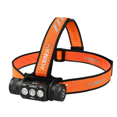
A 2000 lumen headlamp with spot and flood beams, rated IP68 and submersible to 2 metres, with a 141 metre beam and up to 30 hours on low.
Explore →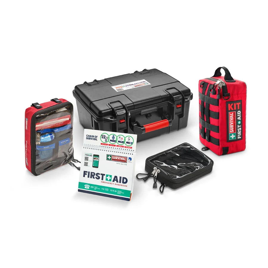
A 142-item marine first aid kit built around the Australian Scale G requirement, with a workplace kit, a Scale G module and a handbook packed in a large waterproof box.
Explore →
Push-to-talk radio that uses 4G mobile networks where there is coverage and a built-in 16-channel analog radio where there is none, with GPS and SOS. Sold as a two-pack.
Explore →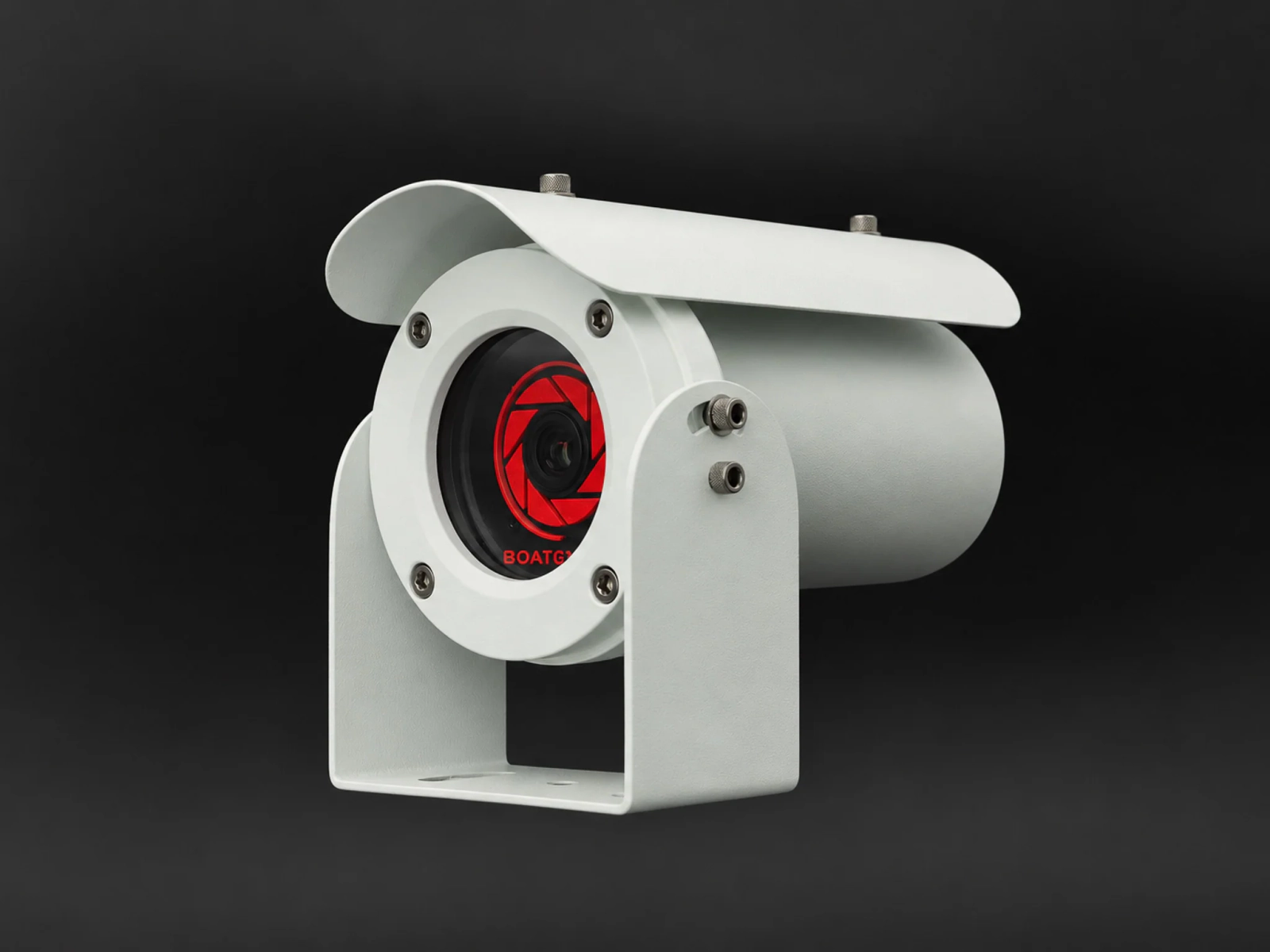
The original BoatEye360 full-colour low-light camera: the same 0.0001 lux sensor as the V2 in a larger 316L stainless housing, with HDMI and analog output, at a lower price.
Explore →