Loading this page…

Loading this page…
Marina service
About
Shute Harbour Marine Terminal is the Whitsunday Regional Council marine terminal at Shutehaven, supporting ferry/tour operations, venue hire and deep-water harbour access.
Service area: Shutehaven, Whitsundays, QLD
Keep exploring
Use this listing for the council-owned marine terminal rather than private marina berths. The terminal reopened after restoration and provides public/transport marine-terminal services, ferry/tour operations and venue facilities at Lot 296 Whitsunday Drive.
The terminal's core services are built around passenger movement. Three finger pontoons provide berthing options for the ferry, water taxi and day-tour fleet, with a terminal hall handling ticketing and baggage claim for island transfers; operators using the facility include Cruise Whitsundays, SeaLink, Reefstar Cruises, Explore Hamilton Island, Ocean Rafting, Pioneer Adventures, island transfer services, the Whitsunday Island Camping Connection and Salty Dog Sea Kayaking.
A marine fuel facility serves both commercial operators and private vessels, a genuine convenience in a harbour with no other public fuel berth. The licensed cafe, known as Explore 74 and trading as 74 Islands Bar and Bistro, serves the departure lounge crowd and locals alike and doubles as a function space with sea views, with retail space adjoining. For the local boating public, the council-managed boat ramp off Shute Harbour Road is the Whitsundays' most used public launching point, though trailer parking is limited and fills early in peak season, and the free fishing jetty draws land-based anglers after tropical species and squid.
Parking is handled through two public car parks, a large waterfront area and a smaller upper facility, both card-payment only with long-term options for island workers and charter crews. The rebuilt seawall and raised platform are themselves a service of sorts: infrastructure rated for the next Debbie rather than the last one. There are no overnight marina berths, no lift-out or repair facilities; vessels needing those go to the adjacent private slipway complex or to Airlie Beach's marinas.
The project was delivered by Queensland contractor Vassallo Constructions and remains one of the larger marine infrastructure rebuilds completed under the NDRRA program in north Queensland.
The terminal sits at the end of a ten-kilometre rainforest drive from Airlie Beach on Shute Harbour Road, and arriving feels like leaving the tourist strip entirely: Conway National Park presses in on both sides and the road ends at the water. For skippers, the harbour entrance is wide, deep and safe in all weathers, one reason the port has anchored the region's tourism since the earliest island launches, and the pontoons are an easy day stop for a private boat needing fuel or a wharfside coffee.
Ferry timings are worth knowing even for non-passengers: Hamilton Island services run about 35 minutes, Daydream Island 50 and Long Island 20, so the pontoon basin cycles through arrivals and departures all day, and wake discipline matters. The fishing jetty beside the terminal fishes best on the run-in tide for trevally and squid, and locals troll the harbour mouth for Spanish mackerel in the cooler months.
Lion's Lookout, a short climb above the terminal, frames the classic photograph of Whitsunday Passage and the islands, and the walking tracks of Conway National Park start almost at the carpark. Practical cautions: parking is card-only and queues form for morning departures, there is no takeaway alcohol or general store at the terminal, and the nearest supermarkets are back in Cannonvale.
The harbour takes its name from Shute Island off the headland, named from HMS Alert in May 1881, and the whole precinct sits within sight of the bays where the Ngaro people sea-rafted among these islands for thousands of years before the first jetty was piled.
Satellite imagery at four heights, from the wider harbour to the berths.
Recently received AIS vessel positions around Shute Harbour Marine Terminal. The traffic display loads automatically.
Live traffic will appear after Shute Harbour Marine Terminal has verified map coordinates.
Deen Maar (the island and adjacent coastal region off south‑west Victoria) is a small but significant offshore island and coastal protected area offering dramatic cliffs, important seabird and seal habitat, cultural values for Gunditjmara and Eastern Maar Traditional Owners, and a clear contrast between exposed Bass Strait seascape and the comparatively sheltered waters inside the Moyne/Port Fairy approaches. From the water it is best treated as an ecological and cultural landmark rather than a place for casual landings: recreational boating activity is concentrated at Port Fairy, Killarney, Y

Yes — South Australian coastal waters include marine parks, aquatic reserves, harbour bylaws and local council restrictions that can affect anchoring, fishing, mooring and access; check the relevant state agencies, local councils and Notices to Mariners for location-specific rules and permit requirements.
Explore →
Activate an EPIRB or PLB only when you are in grave or imminent danger and need search and rescue; use VHF and contact Marine Rescue for urgent help, to request assistance, or to relay information when you have time-critical but non-life-threatening problems.
Explore →
Expect the usual IALA-B lateral system (red and green), cardinal and isolated-danger marks, safe-water and special marks, plus harbour-specific fairway buoys, leading/transit marks and exclusion or speed‑limit buoys. Check local harbour charts and Notices to Mariners for exact positions and light characteristics before entry.
Explore →
Plan to use tide and local knowledge, slow and steerable power, and deliberate positioning to work with—rather than fight—strong streams and eddies when entering or leaving Tasmanian harbours.
Explore →
A practical, Australia-focused guide for planning and sailing around the Whitsunday Islands: weather and seasons, navigation and anchoring, moorings and parks, provisioning and charters, safety and common mistakes, plus checklists and next steps.
Explore →A practical guide for recreational sailors on using VHF marine radios safely and effectively in Australian waters: basic operation, channel use, emergency procedures, DSC basics, common mistakes and a ready checklist for pre-departure and on-water use.
Explore →Practical guide for recreational sailors planning passages, anchorages and visits to Ningaloo Reef and the Exmouth coast. Covers anchoring considerations, marine park rules and how local weather, tides and currents affect safety and enjoyment.
Explore →A practical guide for recreational sailors planning voyages to Esperance and the Recherche Archipelago: what to expect, key planning considerations, common anchorages, safety and communications, equipment recommendations and sensible steps for a successful trip in this remote southern WA cruising area.
Explore →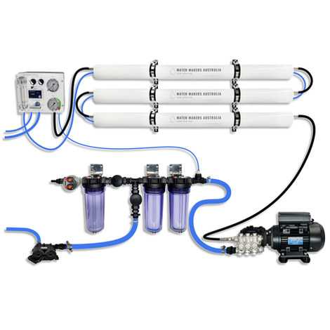
A three-membrane modular watermaker with 200 L/h nominal output and up to 240 L/h family-level marketing, for larger crews and heavy use.
Explore →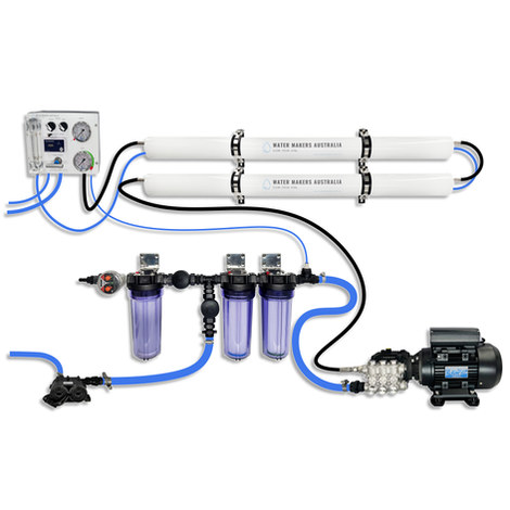
A two-membrane modular watermaker with 140 L/h nominal output, aimed at families and liveaboards that want more water per run.
Explore →Burke Yachtsman Gear Bag 40L - Shop Now Zip Pay | Tamar Marine Skip to content 59 – 63 Holbrook Street, Invermay Online Shop Open 24/7 Products search Contact us 1300 MARINE $ 0.00 0 Cart Burke Yachtsman Gear Bag 40L $ 79.90 Colour Choose an option Black Blue Black Blue Clear - Burke Yachtsman Gear Bag 40L quantity + Add to cart Enquire about this product SKU BAGB-Y24/BLACK* Category Bags - Sail & Gear A Burke classic and customer favourite, the Yachtsman’s Gear Bag is built tough to handle wet, salty conditions while keeping your gear dry and protected. Made from double coated waterproof…
Explore →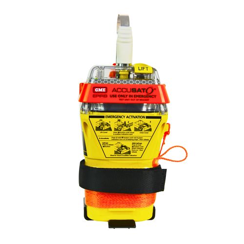
A 10‑year battery EPIRB with integrated GNSS (supports GPS and Galileo), infrared strobe and 121.5 MHz homing signal. Approved for worldwide COSPAS‑SARSAT operation.
Explore →